
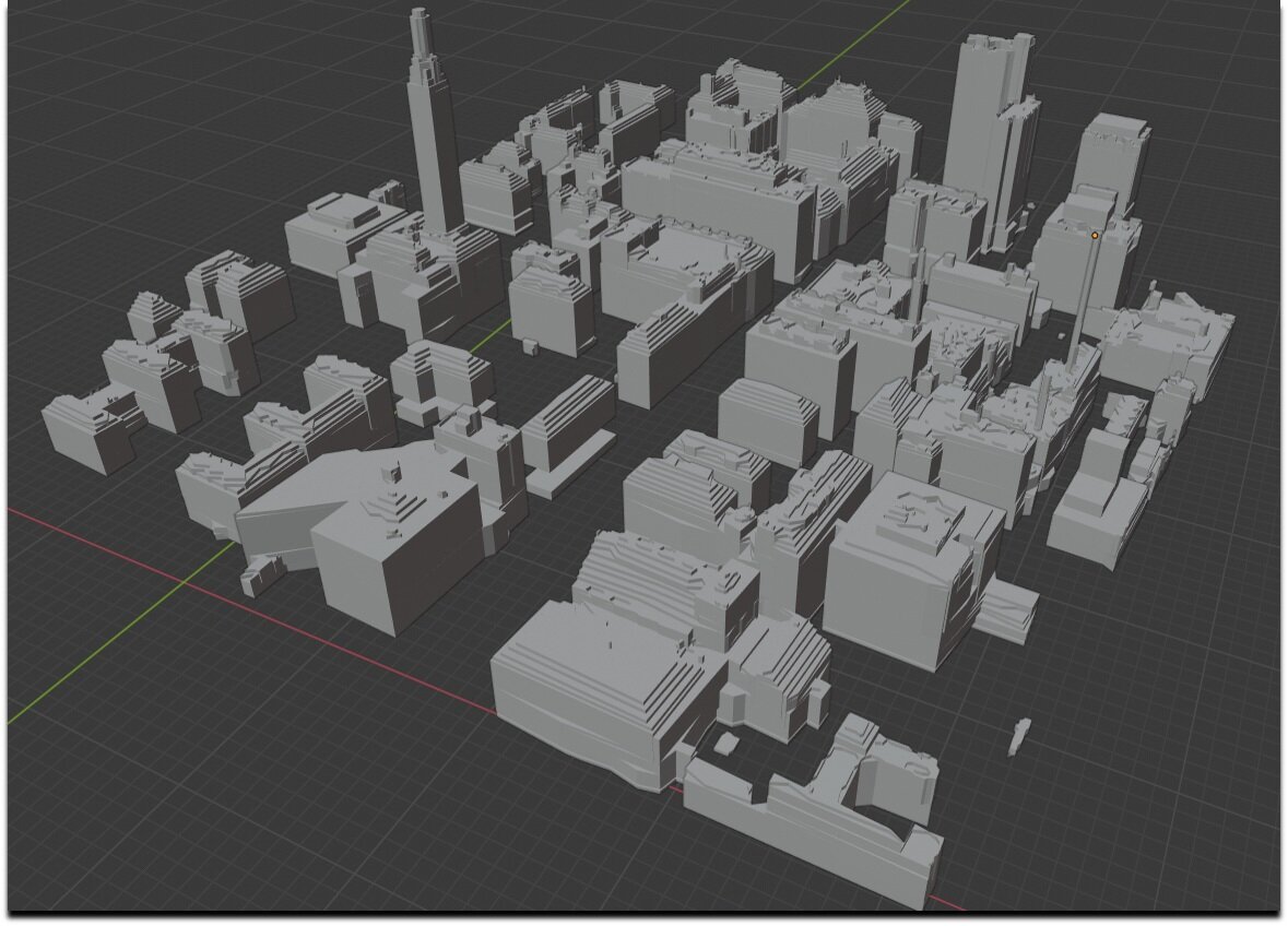

Automated Feature Extraction
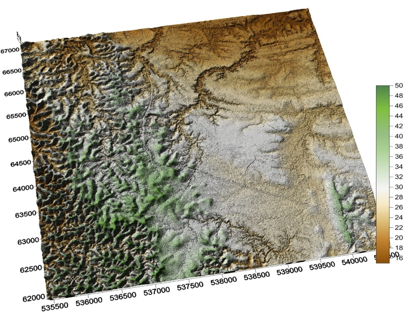
Starting with 3D data originated from either laser altimetry or stereo imagery the algorithms developed here at University of Texas provide a means to push a button to produce 3D objects (buildings, vegetation, water bodies etc.) and terrain surface representation from the individual measurements. All of the software are automated and leverage machine learning and deep learning techniques.
Additionally, the 3DGL team provides kinematic analytics to 3D environments that indicate tactical aides for trafficability, collision avoidance, conceal and cover, and line of sight determination. With high resolution 3D data, the 3DGL algorithms can find geospecific windows, doors and building volumes with additional capabilities for change detection and geolocation accuracy and precision for targeting operations.


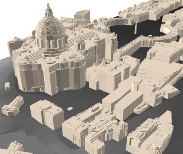
Automated output of 3D buildings at St. Peters Square using the airborne lidar data to the left.